Προσφέρουμε καθημερινά ΔΩΡΕΑΝ λογισμικό με άδεια χρήσης, που θα αγοράζατε σε διαφορετική περίπτωση!
iPhone Giveaway of the Day - Nod
To Nod
είναι διαθέσιμο ως Giveaway of the day!
Έχετε περιορισμένο χρόνο να το κατεβάσετε και να το εγκαταστήσετε.


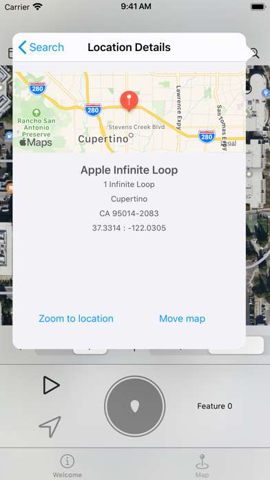
Nod uses the GPS capability of an iOS device to make it simple to plot outdoor spaces and display this on a map or export to share with others.
It is for anybody who has a need to record a real life location on a map or compare locations on a map back to real life. This could be farmers, builders, scientists, archaeologists, systems developers or anybody with an interest in maps.
At a glance:
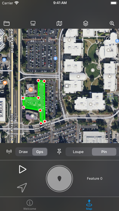
+ Use your position on the ground to mark areas of a map
+ Draw and create geographic data straight onto a map or satellite image
+ Import and visualise geographic data
+ Use the app to perform length and area calculations
+ Use on screen 'rulers' to quickly measure real life features
+ Tamper evident
+ Share geographic data with others in various formats
+ Optimised for touch screen devices
Nod also shows the users location in relation to the survey making it possible to make virtual boundaries and perimeters, for example to mark out a physical boundary where is is difficult or not possible to remain within line of sight of marker posts. Data can be imported in the common open source GeoJSON format.
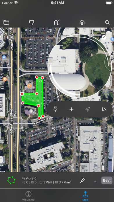
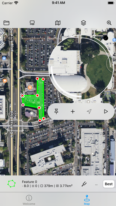
Geographic data in the app is made up of multiple layers. Layers group together collections of features. A feature represents some real life geographical feature as a list of coordinates. Features can be line strings, polygons, points and so on. These features are then drawn onto a map. Polygons can contain inner polygons which are 'cut outs'.
Individual points in features can be adjusted with high accuracy using the app 'draw' mode. Draw mode adds a 'loupe' to make accuracy easy on a touch screen device by magnifiying the map underneath it.
The loupe also provides access to the ruler system. Rulers can be added to the map to mark out temporary measurements and angles. They are guides and are not included when data is exported.
Complex and accurate features can be created by combining multiple features and applying geometric operations such as difference, xor and others. Messy data sources can be processed and made orderly with convex and concave hull operations
The Nod file format (.nod) stores a complete hashed history of the actions taken to create it. This means it has a complete undo history but also provides confidence that the data is as the original creator intended. Exported data in file formats that do not supoport this facitilty should use other means to prove authenticity.
Data can be exported in GeoJSON, CSV, HTML, COLLADA (DAE) formats. COLLADA files can be used when generating data for scaled 3D modelling applications.
Please note:
The app only uses the device GPS system when it is in use. In addition the GPS system is manually operated in order to conserve power. The user also has control over the desired accuracy of the GPS to further reduce power consumption if necessary. When activated and on maximum accuracy the app will draw considerable power as a result of GPS updates. Care should therefore be taken to reduce energy consumption when this is an issue.
Προγραμματιστής:
Robert Atherton
Κατηγορία:
Productivity
Έκδοση:
1.4.1
Μέγεθος:
9.58 MB
Βαθμολογία:
4+
Γλώσσες:
English
Συμβατότητα:
iPhone, iPad

Σχόλια σχετικά με το Nod