毎日 通常購入しなくては使用できないソフトウエアを無料で提供します!
iPhone Giveaway of the Day - Range Finder Tool
このgiveawayオファーはすでに期限が切れています。Range Finder Toolが今紹介されています。
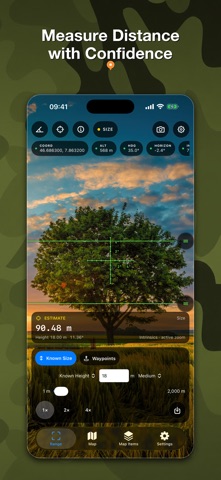
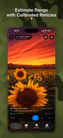
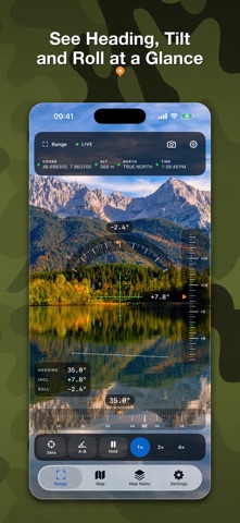
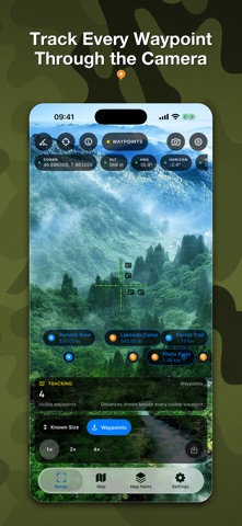
Turn your iPhone or iPad into a practical field toolkit for camera measurement, maps, waypoints, compass work, and astronomical planning.
RangeFinder brings the instruments you need into one focused app. Estimate a distance, inspect an angle, save a waypoint, measure a shape on the map, or plan around sunlight without breaking your workflow.
CAMERA INSTRUMENTS
• Estimate distance or height from an object of known size.
• Measure distance with LiDAR on compatible devices.
• Read heading, inclination, and roll, then capture an A–B angle.
• Use Angle Survey with crisp, calibrated vector reticles.
• Save camera, reticle, measurement, or full-screen compositions.
MAPS THAT GO WITH YOU
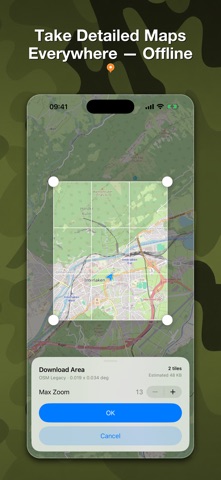
• Work with raster maps and detailed OSM vector maps up to zoom level 19.
• Download supported map areas for use away from a connection.
• Start with 512 MB of offline-map storage; save your first offline map to receive another 512 MB.
• Search and inspect coordinates in Decimal Degrees, DMS, UTM, MGRS, Plus Codes, and GeoHash.
WAYPOINTS WITH CONTEXT
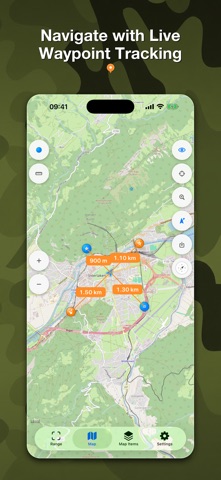
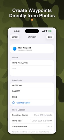
• Create waypoints on the map or from a photo’s GPS metadata.
• Choose from 175 icons so every place is easy to recognize.
• Add notes, photos, and voice messages.
• Track selected waypoints on the map, compass, and live camera with their name and distance.
MEASURE AND PLAN
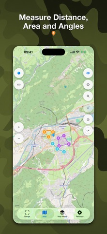
• Draw distances, polylines, angles, rectangles, polygons, areas, and circles directly on the map.
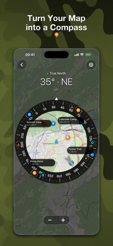
• Use magnetic or true north, waypoint bearings, map rotation, and compass calibration.
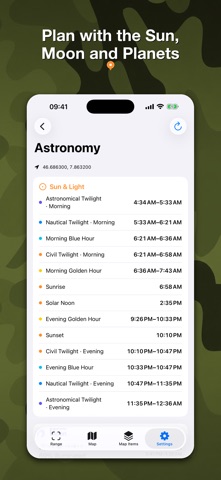
• Plan with sunrise, sunset, civil, nautical, and astronomical twilight, golden and blue hours, Moon phase, and planet positions—calculated on device.
SAVE YOUR FIELDWORK
Keep range observations, captures, waypoints, attachments, and map measurements organized for later. A safe migration assistant can bring compatible waypoints, media, and settings forward from the previous app.
Camera frames and photo-location analysis are processed on your device. Availability and quality depend on device sensors, permissions, lighting, surface conditions, and location accuracy. Measurements are estimates and are not intended for safety-critical surveying or navigation.
開発者:
Natalia Gavrylova
種類:
Navigation
バージョン:
3.0
サイズ:
24.39 MB
批評ポイント:
4+
言語:
English, French, German, Italian, Russian, Spanish, Ukrainian
互換性:
iPhone, iPad
コメント Range Finder Tool