Her gün sizlere, piyasa değeri onlarca dolar olan bir programı tamamen ücretsiz olarak sunuyoruz!
iPhone Giveaway of the Day - Skispor
Skispor
sizin için Giveaway of the day farkıyla bedava!
Bu programı indirmek ve kurmak için sınırlı zamanınız var.

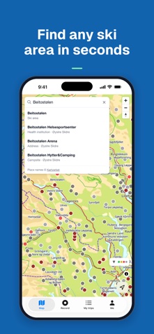
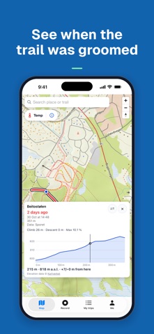
Skispor shows how long ago cross-country ski trails in Norway were groomed. Open the map and see at a glance which trails were groomed recently and which have not been groomed for a while.
THE MAP
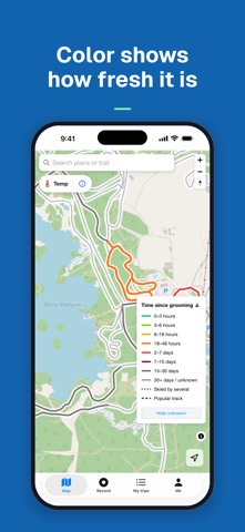
Every section of trail is colored by the time since it was last groomed:
- Green: 0–3 hours
- Light green: 3–6 hours
- Yellow: 6–18 hours
- Orange: 18–48 hours
- Red: 2–7 days
- Dark red: 7–15 days
- Dark gray: 15–30 days
- Light gray: 30+ days or unknown
The legend ("Time since grooming") sits on the map and can be folded away.
DETAILS FOR EVERY SECTION
Tap a section to see which ski area it belongs to, how long ago it was groomed and how long it is. Lit trails show as dashed yellow lines on the map.
ALL OF NORWAY
Zoom out to see over 300 ski areas in Norway and Sweden as markers, and zoom in to see each trail. Search for a place or trail to jump straight there.
MY TRIPS
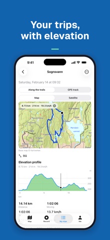
Record your ski trip with the phone, or import a GPX, TCX or FIT file from your watch. See where you skied on the trails, with distance, time and an elevation profile. Heart rate from Apple Health is used only if you consent, and only on your phone. Your trips are private: without an account they stay on your phone, and if you sign in they are also stored in your account, where nobody else can see them.
FOR TRAIL ASSOCIATIONS
Always free for clubs. Import your trails as GPX, GeoJSON or KML, or record them with the phone. In groomer mode the trails you have groomed turn green on the map as soon as the trip is uploaded, and the club can show trail status on its own website.
YOUR LOCATION
Allow location access to see yourself as a blue dot on the map and find the trails around you. The blue dot is only shown on your phone. Trips you record are saved in your account if you sign in.
TEMPERATURE
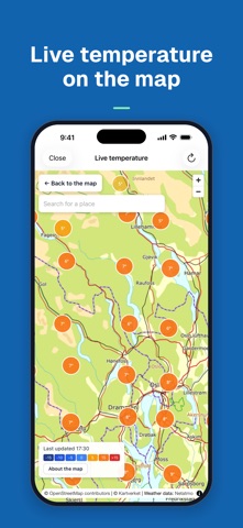
"See live temperature" opens a map with temperature readings from private Netatmo weather stations. The link includes the map center, rounded to about one kilometer.
SIMPLE
Free and without ads. You do not need an account to use the map. The app is available in English, Norwegian, Swedish, Danish, Finnish, Icelandic, German, French and Dutch.
Grooming data comes from loyper.net. How often an area is updated depends on the local trail association and groomer. Before and after the season most trails are gray.
Hazırlayan:
Morten Punnerud
Kategori:
Health & Fitness
Sürüm:
2.2
Boyut:
9.79 MB
Değerlendirme:
4+
Diller:
Danish, Dutch, English, Finnish, French, German, Bokmål, Swedish
Uyumluluk:
iPhone, iPad

Skispor üzerine yorumlar