Every day we offer FREE licensed iOS apps and games you’d have to buy otherwise.
iPhone Giveaway of the Day - StationWeather - Aviation Weather and Charts
StationWeather - Aviation Weather and Charts
is available as a Giveaway of the day!
You have limited time to download, install and register it.

StationWeather is a must-have weather app when you’re out flying. Automatic analyzation combined with a beautiful presentation of weather data is what makes StationWeather so useful, whether you’re a passionate hobby pilot or working in an airline cockpit.
+++ Feature Overview +++
- the most intuitive all-in-one aviation weather app
- METARs, TAFs, NOTAMs, Weather Charts and more
- complete decoding of weather reports with beautiful graphical presentation of data
- advanced analysis of different sources of weather information
We're convinced that StationWeather will become your new favorite aviation weather app. But since it is important to try before you buy, please feel free to check out the free version of StationWeather first. It allows you to use most of the features of the full version, and it is limited to 3 saved stations.
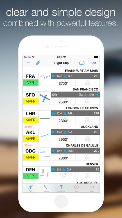
StationWeather groups stations on clips. Within that clip, you can already see a quick analysis of the stations you added, including
- flight conditions such as VFR/IFR
- applicable ILS minima like CAT I, II or III
- the current wind situation for the most favorable runway and
- current ceiling and visibility.
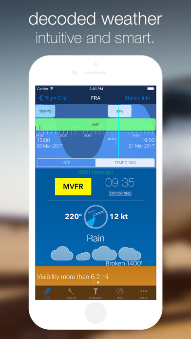
The details section for each station shows the entire METAR and TAF reports, 100% decoded on a beautiful graphical user interface.
- StationWeather offers complete Time Zone support, which means that you can easily switch between UTC, Device Time and Local Station Time. To do so, just tap on the METAR publishing time or the selected TAF time.
- The airport’s runway layout is displayed within the wind compass rose, allowing for a visual interpretation of the current wind situation.
- By analyzing previous METAR reports in the background, StationWeather displays trends for the reported pressure, temperature and dewpoint.
StationWeather deeply analyzes TAF reports and transforms them to Live TAFs. All TAF elements are being decoded and then laid out on a graphical timeline. On that timeline, you can set the time cursor to any specific point and instantly see the combined weather information of the relevant TAF elements for that time, just like the decoded METAR report.
Even the flight conditions (VFR/IFR or CAT I/II/III) are calculated using the combined TAF elements. And for that extra bit of information, local sunrise and sunset times are also displayed directly on the timeline, allowing you to understand and analyze the forecast even better.
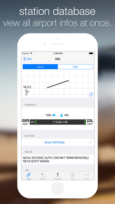
The Station Info page takes you right to a more in-depth info screen of the current station.
- Check the airport’s runways with their published distances and the calculated wind components from the current METAR
- View current NOTAMs for the station and its FIR
- View Sunrise and Sunset time and the local time zone of the station
- Access raw METAR and TAF data (long-tap the information to copy it to the clipboard)
- More information like coordinates, elevation, pressure altitude and density altitude using the current weather report
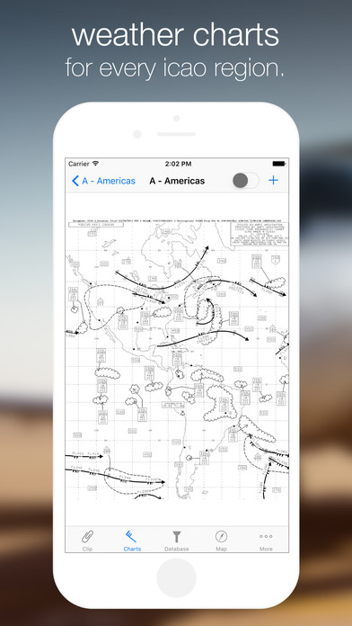
StationWeather features over 600 weather charts, covering every ICAO region of the world. Choose between high level wind/temperature charts, significant weather charts (SIGWX), plus synoptic charts for the NAT region.
To view only the charts that are important to you, StationWeather allows you to create chart sets, which display all of your favorite charts in one place.
Using the Database tab you can access every single station available in StationWeather just like that. You can choose to view nearby stations, or search for the station’s ICAO-code, 3-letter-code, or its name. All the information that you are used to see on the Station Info page will be displayed right away.
Developer:
Oliver Puetz
Category:
Weather
Version:
4.0
Size:
19.93 MB
Rated:
4+
Languages:
English
Compatibility:
iPhone, iPad, iPod touch


Comments on StationWeather - Aviation Weather and Charts