Every day we offer FREE licensed iOS apps and games you’d have to buy otherwise.
iPhone Giveaway of the Day - National Hurricane Center Data
National Hurricane Center Data
is available as a Giveaway of the day!
You have limited time to download, install and register it.


Download the most comprehensive Hurricane Tracker app for iOS.
MAIN FEATURES INCLUDE:
+ GOES Satellite Imagery Animations
+ National Hurricane Center Products
+ National Weather Service Alerts
+ Weather Prediction Center Graphics
+ Tropical Weather Push Notifications
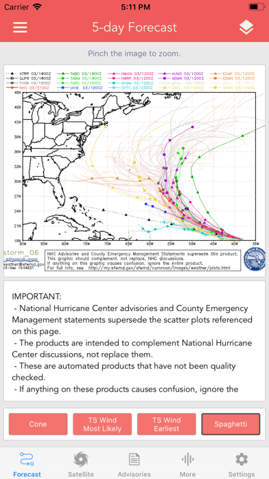
+ Spaghetti Models
GRAPHICAL PRODUCTS INCLUDE:
Forecast Graphics
- Spaghetti Models
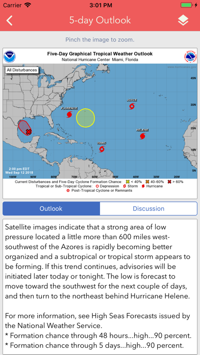
- 5-Day Tropical Weather Outlook
- 2-Week Global Tropics Hazards Outlook
- 3-Day Excessive Rainfall Outlook
- 7-Day Quantitative Precipitation Forecast
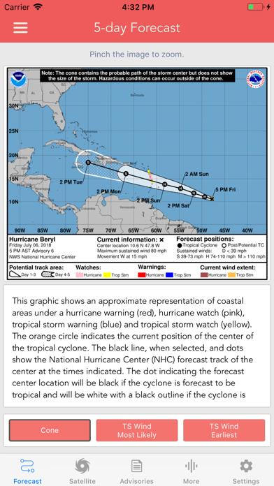
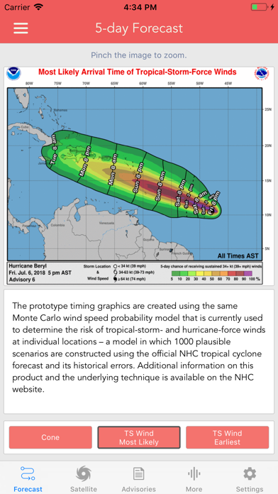
Storm Specific Graphics
- Key Messages
- Cone Track Forecast
- Tropical Storm Wind (Most Likely)
- Tropical Storm Wind (Earliest)
- Hurricane Wind Probability
- Surface Wind Field
- Surface Wind Analysis
- Wind / Track History
- Rainfall Forecast
- Flash Flood Risk
Local Storm Threat Graphics
- Flooding Rain Threat
- Wind Threat
- Surge Threat
- Tornado Threat
- Rainfall Totals
- Wind Warnings
Note: Local threat graphics are typically not available until shortly before storm landfall.
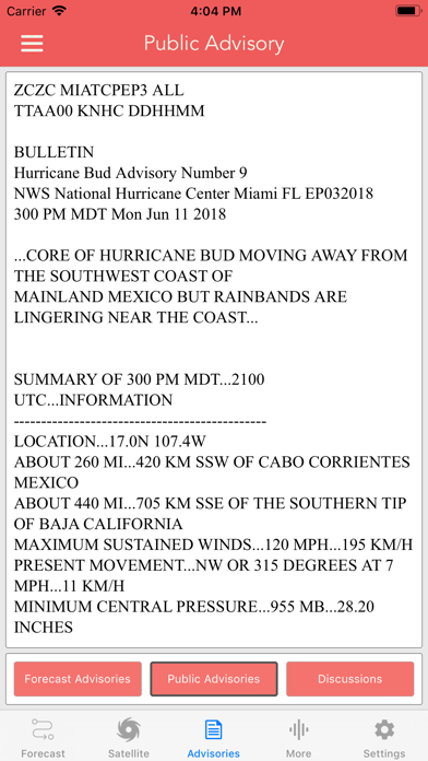
TEXT PRODUCTS INCLUDE:
- Tropical Weather Outlook
- Forecast Advisories
- Public Advisories
- Tropical Discussion
- Wind Analysis
- Dvorak Storm Intensity Index
WEATHER MAP OVERLAYS INCLUDE:
- Hurricane Track & Intensity
- Potential Storm Surge Flooding
- NASA Sea Surface Temperature
- NOAA Weather Radar
- NWS Warnings, Watches & Advisories
Note: The National Weather Service map overlay displays color-coded observed and forecasted weather hazards. Detailed alert information can be viewed by simply tapping on the map.
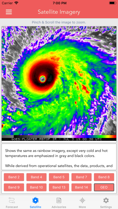
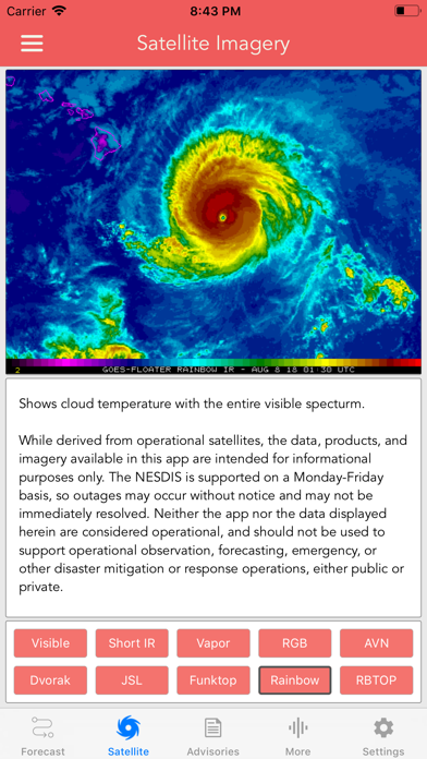
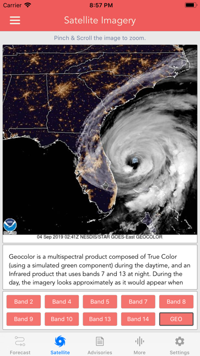
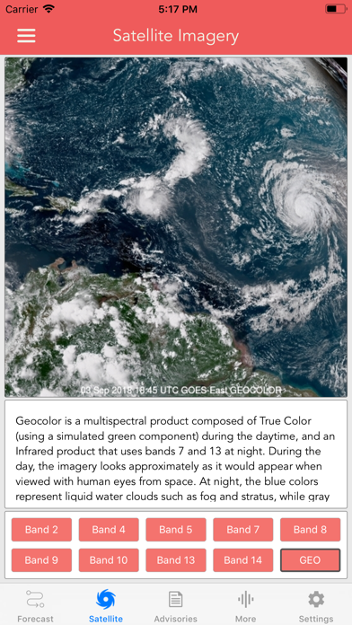
GOES SATELLITE IMAGERY INCLUDES:
Fifteen (15) Satellite Imagery Filters
- Visible (Band 2)
- Near IR (Bands 4 & 5)
- Infrared (Bands 7, 8, 9, 10, 13, 14 & 16)
- Nighttime Microphysics
- Day Cloud Phase
- True Color
- Air Mass
- Sandwich
GOES-East Regions
- CONUS
- Atlantic (wide)
- Gulf of Mexico
- Caribbean
- Atlantic Coast
- Puerto Rico
- Southeast
- Mexico
- Great Lakes
- Northeast
- South Mississippi
- Upper Mississippi
- Northern Rockies
- Southern Rockies
- South Plains
- Pacific Southwest
- Pacific Northwest
GOES-West Regions
- Pacific (wide)
- Tropical Pacific
- North Pacific
- West Coast
- Hawaii
- Alaska
- Southwest
- Northwest
- Full Disk
Developer:
LW Brands, LLC
Category:
Weather
Version:
1.4.1
Size:
94.48 MB
Rated:
12+
Languages:
English, French
Compatibility:
iPad

Comments on National Hurricane Center Data