Προσφέρουμε καθημερινά ΔΩΡΕΑΝ λογισμικό με άδεια χρήσης, που θα αγοράζατε σε διαφορετική περίπτωση!
iPhone Giveaway of the Day - National Hurricane Center Data
To National Hurricane Center Data
είναι διαθέσιμο ως Giveaway of the day!
Έχετε περιορισμένο χρόνο να το κατεβάσετε και να το εγκαταστήσετε.


Download the most comprehensive Hurricane Tracker app for iOS.
MAIN FEATURES INCLUDE:
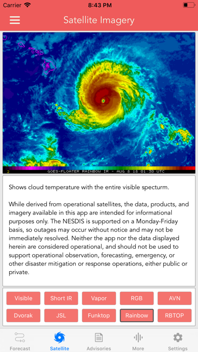
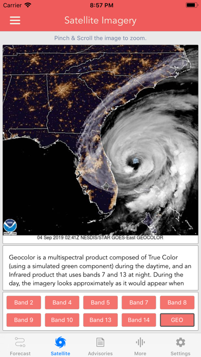
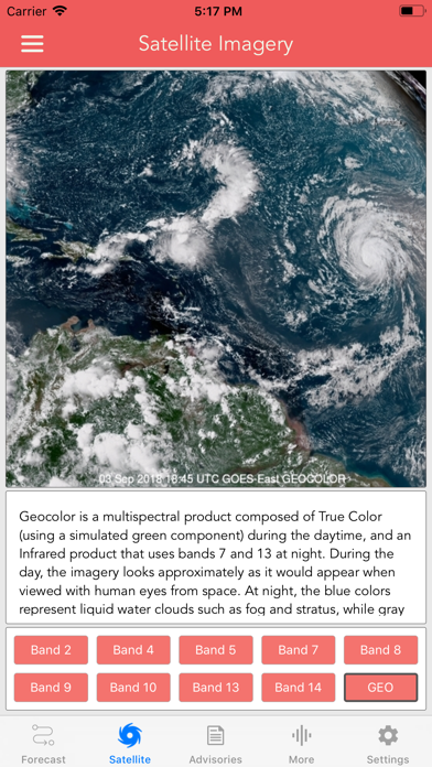
+ GOES Satellite Imagery Animations
+ National Hurricane Center Products
+ National Weather Service Alerts
+ Weather Prediction Center Graphics
+ Tropical Weather Push Notifications
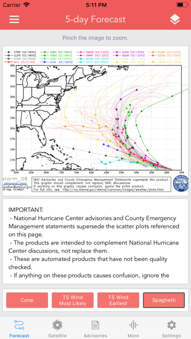
+ Spaghetti Models
GRAPHICAL PRODUCTS INCLUDE:
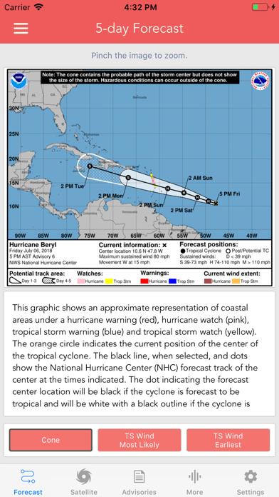
Forecast Graphics
- Spaghetti Models
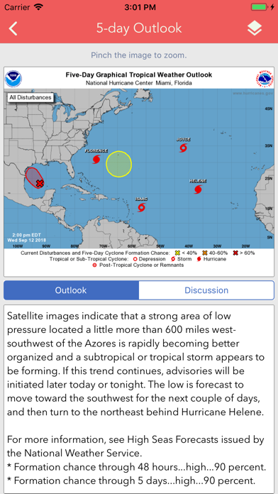
- 5-Day Tropical Weather Outlook
- 2-Week Global Tropics Hazards Outlook
- 3-Day Excessive Rainfall Outlook
- 7-Day Quantitative Precipitation Forecast
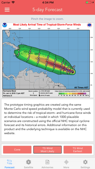
Storm Specific Graphics
- Key Messages
- Cone Track Forecast
- Tropical Storm Wind (Most Likely)
- Tropical Storm Wind (Earliest)
- Hurricane Wind Probability
- Surface Wind Field
- Surface Wind Analysis
- Wind / Track History
- Rainfall Forecast
- Flash Flood Risk
Local Storm Threat Graphics
- Flooding Rain Threat
- Wind Threat
- Surge Threat
- Tornado Threat
- Rainfall Totals
- Wind Warnings
Note: Local threat graphics are typically not available until shortly before storm landfall.
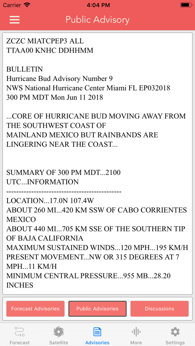
TEXT PRODUCTS INCLUDE:
- Tropical Weather Outlook
- Forecast Advisories
- Public Advisories
- Tropical Discussion
- Wind Analysis
- Dvorak Storm Intensity Index
WEATHER MAP OVERLAYS INCLUDE:
- Hurricane Track & Intensity
- Potential Storm Surge Flooding
- NASA Sea Surface Temperature
- NOAA Weather Radar
- NWS Warnings, Watches & Advisories
Note: The National Weather Service map overlay displays color-coded observed and forecasted weather hazards. Detailed alert information can be viewed by simply tapping on the map.
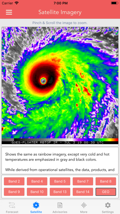
GOES SATELLITE IMAGERY INCLUDES:
Fifteen (15) Satellite Imagery Filters
- Visible (Band 2)
- Near IR (Bands 4 & 5)
- Infrared (Bands 7, 8, 9, 10, 13, 14 & 16)
- Nighttime Microphysics
- Day Cloud Phase
- True Color
- Air Mass
- Sandwich
GOES-East Regions
- CONUS
- Atlantic (wide)
- Gulf of Mexico
- Caribbean
- Atlantic Coast
- Puerto Rico
- Southeast
- Mexico
- Great Lakes
- Northeast
- South Mississippi
- Upper Mississippi
- Northern Rockies
- Southern Rockies
- South Plains
- Pacific Southwest
- Pacific Northwest
GOES-West Regions
- Pacific (wide)
- Tropical Pacific
- North Pacific
- West Coast
- Hawaii
- Alaska
- Southwest
- Northwest
- Full Disk
Προγραμματιστής:
LW Brands, LLC
Κατηγορία:
Weather
Έκδοση:
1.4.1
Μέγεθος:
94.48 MB
Βαθμολογία:
12+
Γλώσσες:
English, French
Συμβατότητα:
iPad

Σχόλια σχετικά με το National Hurricane Center Data