Iedere dag bieden wij GRATIS software met licentie waarvoor je normaliter moet betalen!
iPhone Giveaway of the Day - NOAA Nautical Charts & Map
Deze giveaway is verlopen. NOAA Nautical Charts & Map is nu beschikbaar op de normale manier.
The premium and best app for Nautical Navigation Charts and Maps:
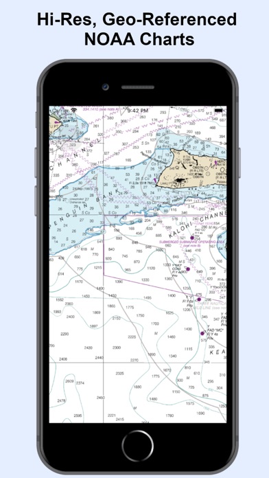
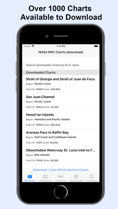
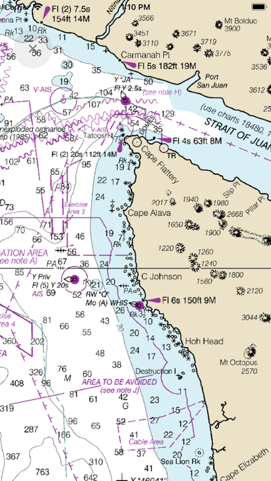
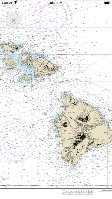
* 1000+ NOAA Raster Navigational Charts (RNC) available for download and for offline use. RNC are high resolution, full-color, geo-referenced, digital images of NOAA paper nautical charts.
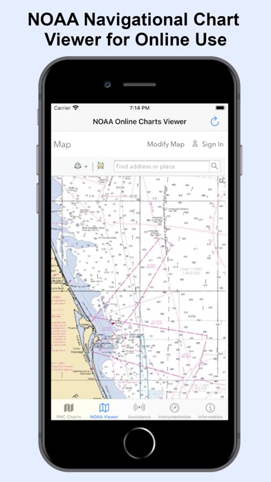
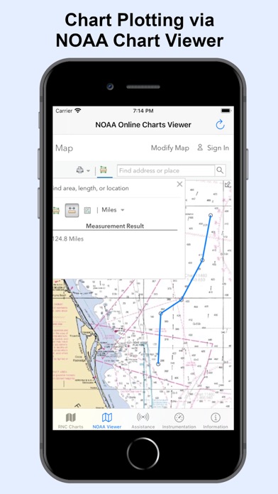
* 1000+ NOAA Navigational Charts for online use that includes GPS location, navigation plotting and more.
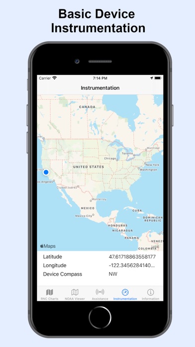
* Basic instrumentation - GPS location, Longitude, Latitude and Device Compass.
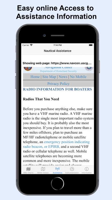
* Assitance Support - Link to Navigation Center, Radio Information.for Boaters.
Additional information about the charts and data provided with this app:
NOAA RNC® charts are full-color, geo-referenced, digital images of NOAA paper nautical charts.
RNCs can be used with global positioning system (GPS) enabled electronic chart systems or other “chart plotter” display systems to provide real-time vessel positioning.
NOAA RNCs comply with the International Hydrographic Organization RNC Product Specification.
RNCs are approved for use by IMO ECDIS mandated vessels only if adequate ENC data is not available. Since complete ENC coverage is available in all U.S. waters, vessels required to use ECDIS may not navigate with NOAA RNCs.
NOAA RNCs DO NOT meet USCG chart carriage requirements for commercial vessels.
NOAA RNCs may be downloaded free from the NOAA chart locator or the NOAA nautical chart catalog.
----------
Electronic Navigational Charts (ENC) are vector data sets that support all types of marine navigation. Originally designed for large commercial vessels using a sophisticated navigational computer called an Electronic Chart Display and Information System (ECDIS), ENCs are now also being used on simpler electronic chart systems and “chart plotters” on many types of ships and by recreational boaters. NOAA ENCs help provide real-time ship positioning, as well as collision and grounding avoidance.
NOAA ENCs comply with the International Hydrographic Organization ENC Product Specification. ENCs are produced around the world by many different countries’ national hydrographic or charting agencies. NOAA maintains more than 1,000 NOAA ENC® datasets over U.S. coastal waters and the Great Lakes. The U.S. Army Corps of Engineers produces a similar product, called Inland ENC (IENC) for many U.S. rivers.
Ontwikkelaar:
Aleksandar Grkov
Categorie:
Navigation
Versie:
1.2
Grootte:
894 KB
Waardering:
4+
Talen:
English
Compatibiliteit:
iPhone, iPad

Reactie op NOAA Nautical Charts & Map